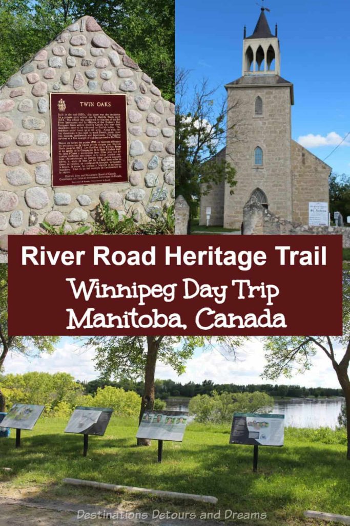
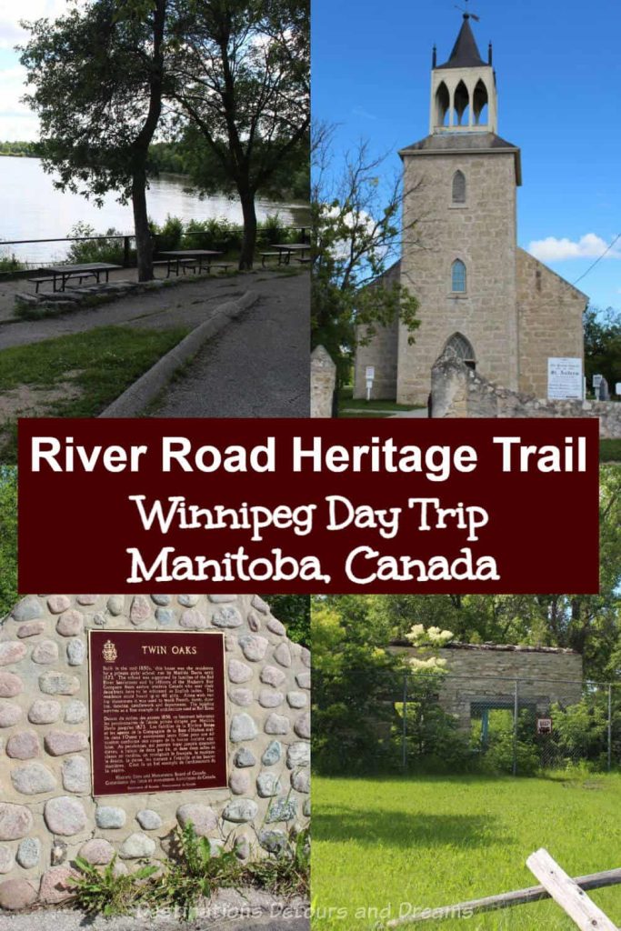
Southern Manitoba’s Red River Heritage Parkway

A scenic riverside drive with historic landmarks north of Winnipeg, Manitoba, Canada makes for a pleasant day trip
If you’re looking for a scenic day drive from Winnipeg, Manitoba, Canada that is also rich with history, follow the River Road Heritage Parkway route. River Road runs off of Highway 9 about 10 kilometres (6 miles) north of Winnipeg’s Perimeter Highway. Several historic stopping points along 11 kilometres of River Road offer interpretive signage and scenic lookouts. A final stop, Lower Fort Garry, is located a few kilometres north of River Road on Highway 9.
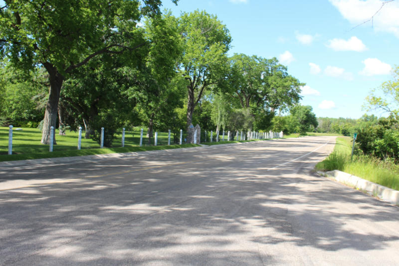
River Road was once an 1800’s cart path. It was also called Inner Road or Road to the Rapids. An interpretive panel at the first stopping point contains an 1857 map. The road is shown as Inner Road on that map. Today, as you drive it, you’ll have scenic views of the Red River along one side. On the other side you’ll see historic stone buildings as well as modern upscale residences on large lots.

A sign at the first stop shows a map of the stops along the route. (Note: Although not one of the stops, the Kenosewun Centre and Museum is marked on the map at Lockport. The facility closed in 2010.)
Stop 1: Trailhead
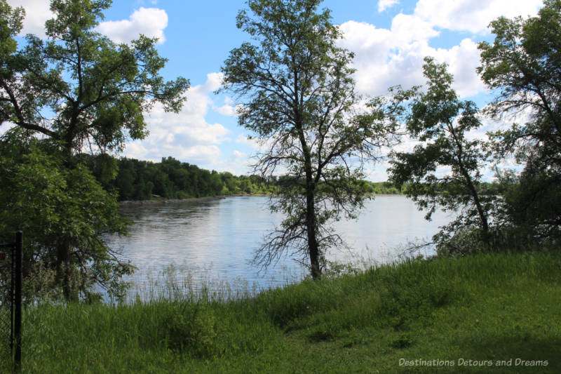
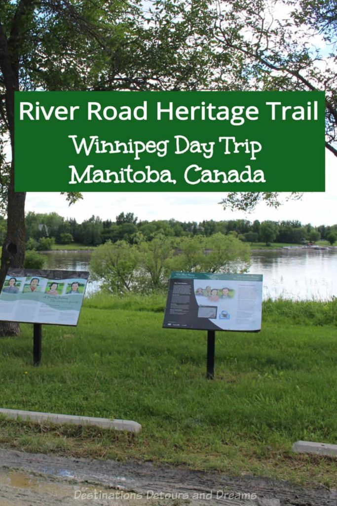
Alongside the river across the street from Larter’s at St. Andrew’s Golf & Country Club, you’ll find the first stop. It is a pretty park setting with a beautiful river view, sitting and picnic area, and several interpretive signs.

A Family Journey was developed as a series of interpretive signs along River Road in 2007 to celebrate the designation of the Red River as a Canadian Heritage River. Signage here introduces you to the Thomas family and invites you to join them as they travel to Lower Fort Garry, known in their day (1845) as Stone Fort, where they will trade snowshoes, venison, and maple syrup for flour, tools, and maybe some sweets for the children.
Stop 2: Fishing Site

The next stop, two kilometres down the road, is another scenic riverside area with several picnic tables and access down to the river.

Signage here talks about the Red River Highway and the types of boats that travelled it. Birchbark canoes were the first method of transportation on the Red River. First Nations were expert in building these light craft. Fur trade voyageurs adopted this type of boat. York boats were developed for the Hudson’s Bay Company York Factory (a trading post on the southwestern shore of Hudson’s Bay). Typically 12.6 metres long (almost the length of a semi-trailer), York boats could carry twice the cargo of a canoe with the same amount of crew. They stopped being used in the 1920s. In 1859, the first paddleboat steamboat travelled the Red River. Steamboats could haul larger loads more quickly and cheaply. By the early 1900s, the railway had replaced the paddle wheelers.

On other signs, you’ll find information about the types of fish in the Red River, the river’s history of flooding, and river lots, narrow strips of land along the river that gave all owners river views and access.
Stop 3: Scott House
Another two kilometres further down on the west side of the road (across the road from the river), you’ll find the ruins of Scott House. The 1855–1856 stone house made of locally quarried limestone replaced an earlier log house. The house represents a typical Red River farm house.

Signage here provides a look into daily life. However, when I visited in June 2024, some of the signs were in almost as rough shape as the house itself.
Unlike the first two stops, there is no parking lot here. You will have to pull over at the side of the road to get out and view the ruins.
Stop 4: Twin Oaks

Less than a kilometre from Scott House, you’ll find a marker for Twin Oaks School. The private girls’ school, run by Matilda Davis, was built in the mid-1850s and ran until 1873. It was supported by families of the Red River Settlement and officers of the Hudson’s Bay Company across western Canada who sent their daughters here to be educated as English ladies. The large stone building still exists and can be seen across the road. It is privately owned and not part of the Heritage Parkway tour.
Other signs beside the marker talk of missionary schools and schools for women.
Stop 5: St. Andrews Church and Rectory

Two kilometres from the Twin Oaks marker, you’ll find St. Andrews-on-the-Red Anglican Church at the corner of St. Andrews Road and River Road. The church was built between 1845 and 1849 to serve the local community of retired Hudson’s Bay Company personnel and English mixed bloods. The Gothic Revival style church was designed by Archdeacon William Cockran (1796–1865), who was instrumental in the establishment of the Anglican Church in Canada. It is one of the early structures to use Tyndall Stone, a limestone quarried in southern Manitoba that is a recognized heritage stone. The work was done by stonemason Duncan McRae (1813–1898), who built several notable structures in the area including the Captain Kennedy House at the next stop.

The cemetery around the church contains the graves of many Hudson’s Bay Company officers and early settlers.

St. Andrew’s Rectory is across the road. It was built in 1854 to house the ministers at St. Andrews and is an excellent example of mid-nineteenth century Red River architecture. After 1938, the ministers lived in the rectory by St. Thomas Church in Lockport. The house was a private home for many years until Parks Canada took it over in the 1980s and reconstructed it using as much of the original stones as possible. Today it houses the St. Andrews Heritage Centre.
Signage on the grounds provides information about the influence Church of England missionaries had upon the lives of the Red River settlers. The interior is open as a museum during summer months. Artifacts in the house provide information about the rectory, the history of the area, and the clergy and missionaries who lived in the house. Read more in my post Manitoba Red River History at St. Andrews Rectory.
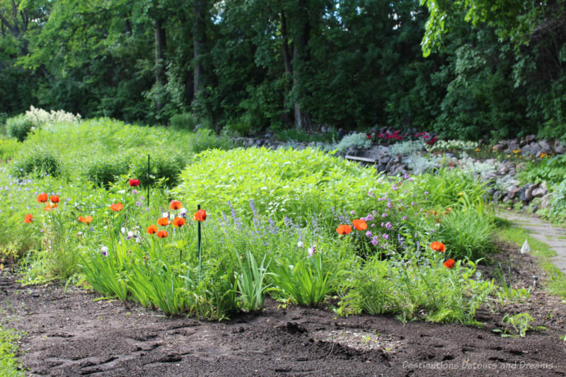
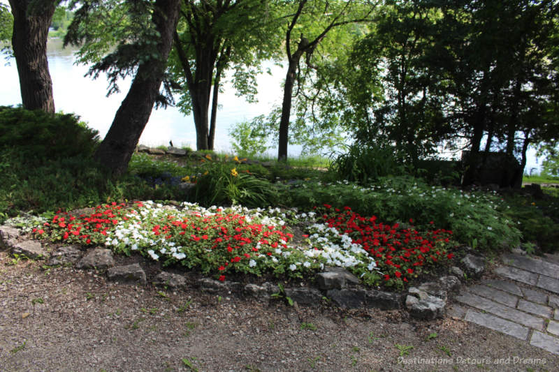
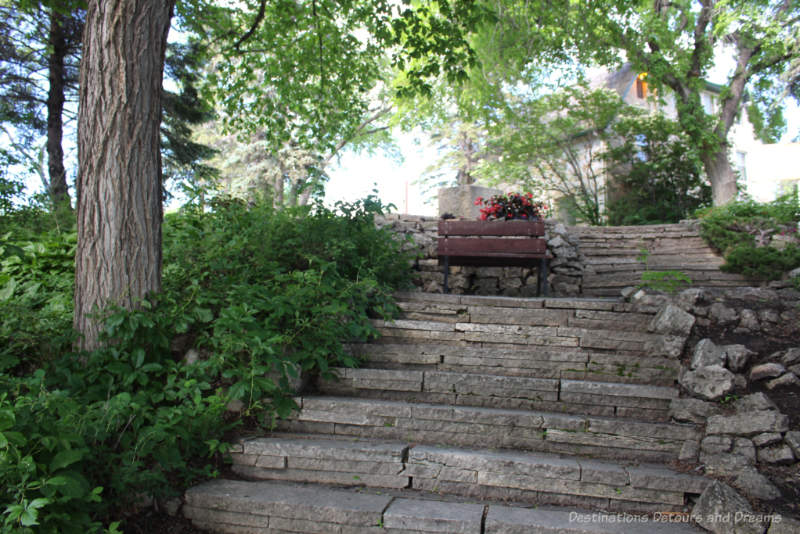
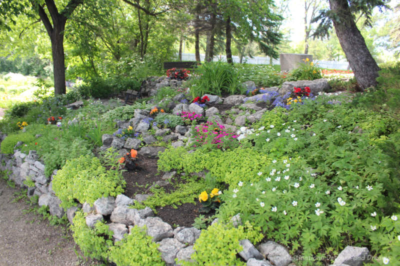
Stop 6: Captain Kennedy’s House and Gardens
Captain William Kennedy House, a Manitoba Provincial Heritage site, is not accessible due to restoration work, but Manitoba Conservation continues to maintain the beautiful gardens around the house.

Kennedy House, originally known as Maple Grove, was constructed in 1866 for Captain William Kennedy (1814–1890), Arctic explorer and advocate of Canadian westward expansion. Born to a Scottish father and a Cree mother, he was a Chief Factor of the Hudson’s Bay Company. He and his wife Eleanor had 9 children. Eleanor was well-respected and taught music at Miss Davis’ school. After Kennedy’s death, she was forced to sell the house to cover his debts. Some say the reason for his debts was the difficulty he had as a mixed-blood businessman in an increasingly race-conscious society. Signage at the site contains more information about Kennedy, his family, and life at Maple Grove.

Heritage Winnipeg wrote an article in 2021 about Captain Kennedy and the history of the house. The house had three owners after the Kennedys before the Province of Manitoba purchased it in 1980 and did some restoration work. Space was created for the Captain Kennedy Tea House and the main floor of the house was open to the public during summer months.
In 2003, the house became privately operated as the popular Maple Grove Tea Room, which had an adjoining museum and hosted many weddings and celebrations. It was shut down in 2015 after an engineering report revealed the house needed structural work. Initial funding for that work was rescinded after a change in government. Funding was provided in phases starting in 2021 when foundation and lower level structural repairs were done. Phase II upgrading and refurbishment of main floor areas is taking place in 2024. Phase III foundation waterproofing, landscaping, and patio repairs are still to be scheduled and may begin later in 2024.

The flagstone paths and flower beds in the garden are part of a traditional English design built in the 1920s by then-owners J.E. McAllister and his wife Caroline.
Stop 7: Quarry Marsh
A marshy area on the west side of River Road, about two kilometres north of Kennedy House near the intersection with Hay Avenue is the remnant of an old stone quarry that supplied limestone to construction projects in the area.
Stop 8: St. Andrew’s Lock and Dam
What is now Lockport had long been a meeting place. The base of St. Andrew’s Rapids (originally called Grand Rapids) was an ideal location for fishers. Herds of bison crossed the river near here and provided food for Indigenous hunters. A community developed here in the early 1850s.

St. Andrews Lock and Dam, now both a National Historic Site of Canada and a National Historic Civil Engineering Site, opened in 1910 to allow easier boat travel over the rapids. It is the only Caméré curtain bridge-dam built in North America and the largest ever constructed. It may be the only surviving moveable dam of its type in the world. It is also the only lock on the Canadian prairies. You can read more about the Lock and Dam and the tradition of summer drives to Lockport for a hot dog in my post St. Andrews Lock and Dam At Lockport, Manitoba.
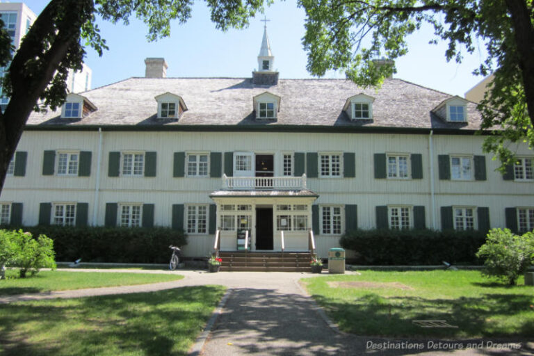
Stop 9: Lower Fort Garry

Lower Fort Garry was originally built in the 1830s for the Hudson’s Bay Company and operated as a company post until 1911.
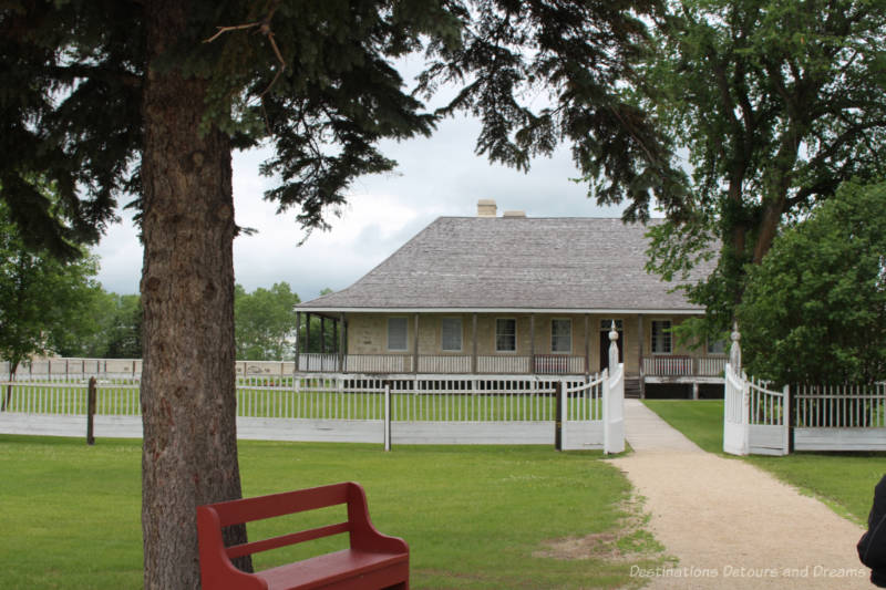
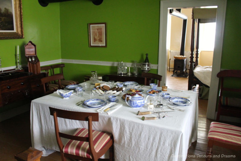
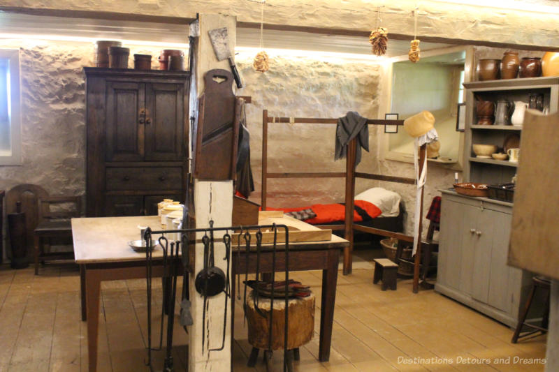
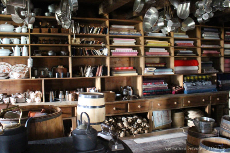
The historic grounds are open year-round. Treaty 1, the first of a series of numbered treated with Indigenous Peoples, was signed here. A monument and flags from seven First Nations along with Canada’s flag and the Union Jack mark the location. From July 1 to Labour Day, you can tour the inside of the restored heritage buildings, which are furnished in period style. Costumed interpreters recreate the life of trappers and traders of the Hudson’s Bay Company. You can also see one of the York boats talked about in signage at Stop 2.

Read more in my post Lower Fort Garry: Life in the Canadian Fur Trade Era.
Travelling The River Road Heritage Parkway
Drive north of the Perimeter Highway on Provincial Trunk Highway 9 (Main Street in Winnipeg) for 10 kilometres (6.2 miles) and turn east onto River Road (Provincial Road 238). When River Road reconnects with Highway 9, continue north for a few kilometres more to the last stop on the trail: Lower Fort Garry. You can return to the city the same way by going down River Road again or stay on Highway 9.
How long the trip takes depends on how long you spend at each stop. It can be half-day or a full-day adventure. The section of River Road from Stop 1 to Stop 8 takes anywhere from 30 minutes (minimal stops) to an hour and a half. You may want to spend additional time in Lockport having lunch or a picnic. Plan to spend two or three hours at Lower Fort Garry when it is open for touring during summer months.

River Road also makes for a nice cycling route.
Stops are shown on this Manitoba government Red River Corridor map.
Never miss a story. Sign up for Destinations Detours and Dreams free monthly e-newsletter and receive behind-the-scenes information and sneak peeks ahead.
PIN IT

I live in a pretty congested area so the first thing I think when I see these pictures is: how peaceful.
Ken, it is quite scenic.
From Eva …
Correction re: Lauder’s Golf Course
The correct name is:
Larter’s at St. Andrews Golf & Country Club
Thanks. Eva. I’ve corrected it. Obviously I am not a golfer or I would have caught that when checking things over. Hope you’re getting a chance to get some golf in this summer.